Beyond Road Tubes & Manual Tally Boards
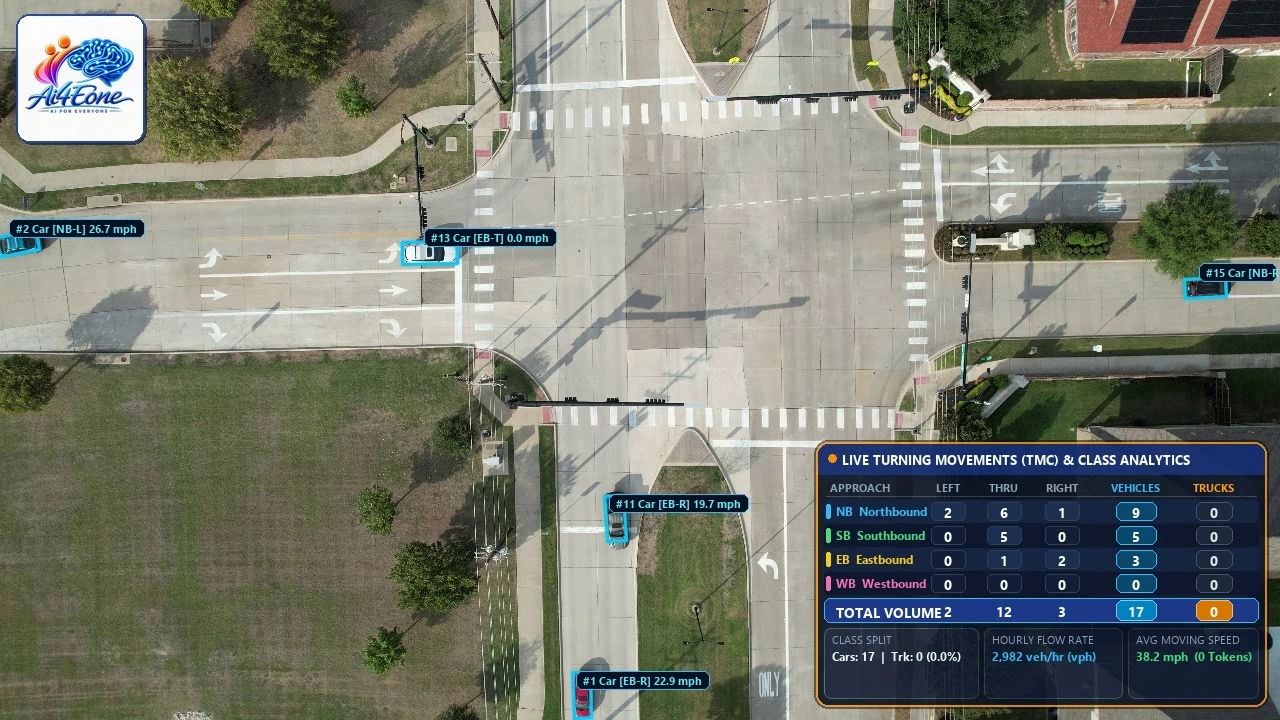
Unmatched visibility. Continuous speed & movement accuracy across the entire intersection.
Traditional pneumatic road tubes, radar guns, and manual clipboard counts only capture isolated points, put field technicians at risk in live traffic, and miss complex lane-changing, queue spillback, and turning speeds inside the intersection box.
AI4Eone’s Aerial Drone Traffic Intelligence Platform captures the complete bird’s-eye view of all four approaches simultaneously—tracking every passenger car and heavy commercial truck from entry to exit with continuous speed measurements and zero disruption to roadway operations.
Field-Calibrated Geometric & Distance Scaling
Every intersection is geometrically calibrated along both the East–West and North–South axes using verified roadway dimensions and MUTCD lane standards—ensuring true physical speed measurements (mph) and accurate vehicle length profiling.
Continuous Trajectory & Speed Study Data Collection
Tracks each individual vehicle across the entire intersection footprint, recording instantaneous speed, average moving speed, peak speed, 85th percentile speed (V85), travel duration, and exact origin-destination movement.
P.E. & PTOE Engineering Review & Sign-Off
Every dataset, speed distribution table, and Turning Movement Count summary undergoes rigorous quality assurance and authentication by a Licensed Professional Engineer (P.E.) and Certified Professional Traffic Operations Engineer (PTOE).