Load a client CRIS extract
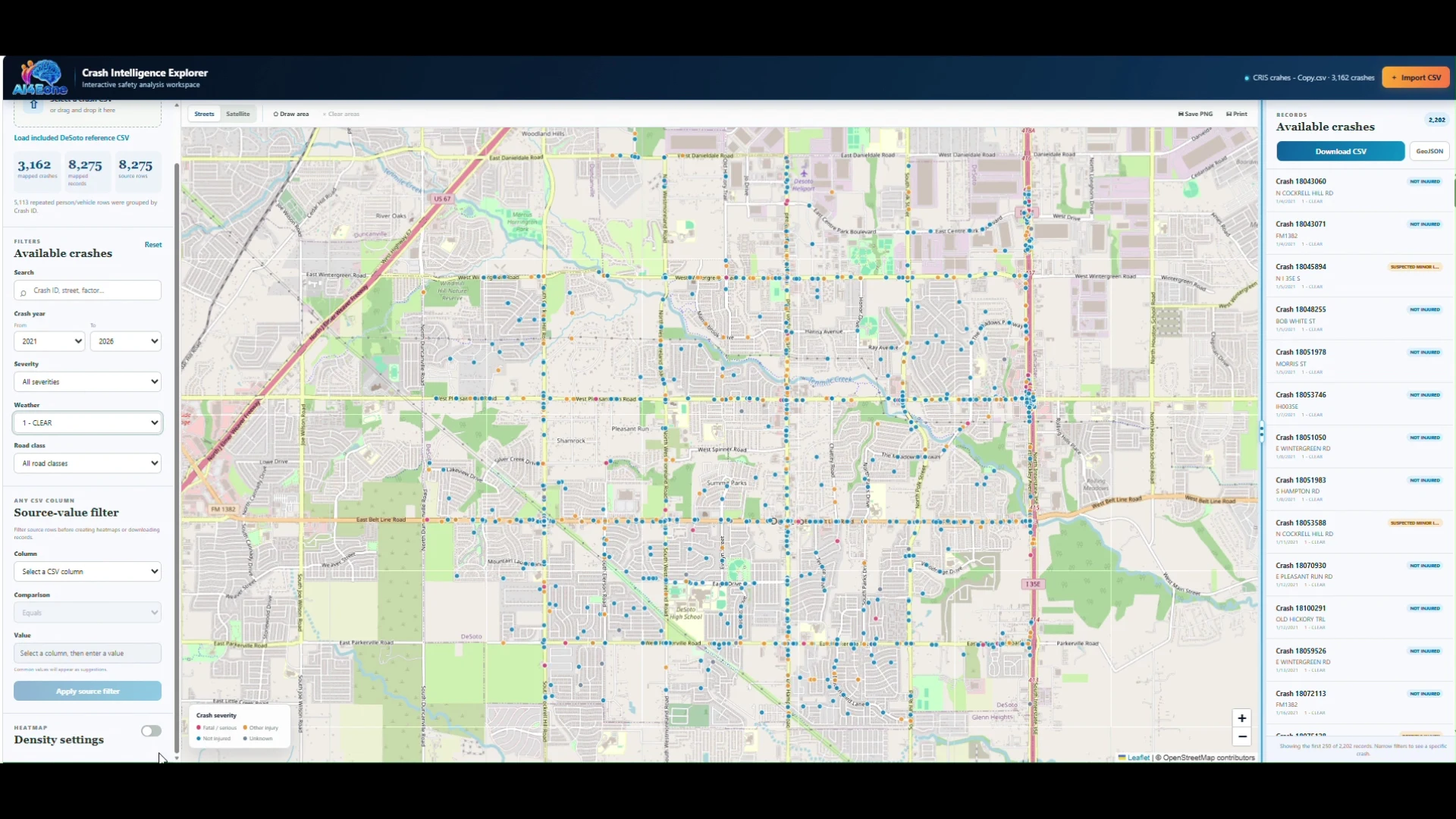
Import the raw TxDOT-formatted CSV and automatically index crash IDs, vehicle records, KABCO severity, weather, lighting, collision type, and coordinates.

Turn raw TxDOT Crash Records Information System (CRIS) exports into clear, mapped safety decisions in seconds—with $0 recurring token cost and no heavy GIS software required. Built specifically for transportation engineers, traffic safety practitioners, and municipal agencies.
Raw CRIS extracts often include multiple rows per incident—separating crash-level, vehicle-level, and person-level records. Generic spreadsheet or mapping workflows easily double-count incidents or require expensive desktop GIS licenses just to screen a corridor.
AI4Eone’s CRIS Crash Intelligence Tool keeps those distinctions visible automatically, so totals are never overstated and every map answers the exact safety question.
Import the raw TxDOT-formatted CSV and automatically index crash IDs, vehicle records, KABCO severity, weather, lighting, collision type, and coordinates.
Instantly toggle between Unique Crash Counts (by Crash ID) and Vehicle-Level Records for accurate corridor screening and density mapping.
Draw custom freehand polygons around any intersection, arterial corridor, school zone, or project boundary and export a clean CSV ready for your HSIP or SS4A safety study.
Built for transportation engineers and traffic-safety practitioners who need defensible answers without a complex GIS production workflow.
Instantly toggle between Unique Crash Counts (by Crash ID) and Vehicle-Level Records so safety totals are never overstated.
Filter across years, crash severity (KABCO), weather, lighting conditions, collision type, or any attribute in your CRIS extract.
Customize heatmap radius, intensity, opacity, and severity weighting from a single lightweight control panel.
Draw freehand polygons around any intersection, arterial corridor, school zone, or project boundary—not just rigid rectangles.
Inspect individual crash attributes directly on the map and export only the spatially selected crashes to a clean CSV for your report.
Runs with $0 AI token cost per run, $0 recurring cloud compute fees, and zero dependency on heavyweight GIS licenses.
Create green-to-red density maps, isolate a corridor or intersection with a custom polygon, review the underlying records, and export the selected crashes for further engineering analysis.
AI4Eone turns traffic-safety and transportation engineering expertise into focused client workflows that run locally, avoid token-dependent analysis, and eliminate heavyweight GIS licensing bottlenecks.